Aéroport international Léopold Sédar Senghor
ABOUT US
Mon - Fri, 2022
7:30 AM – 3:30 PM
Immeuble San Marco
BP 8163 Dakar - Sénégal
+221 33 865 40 27
Contact@satnav-africa.org
Mon - Fri, 2022
7:30 AM – 3:30 PM
Immeuble San Marco
BP 8163 Dakar - Sénégal
+221 33 865 40 27
Contact@satnav-africa.org
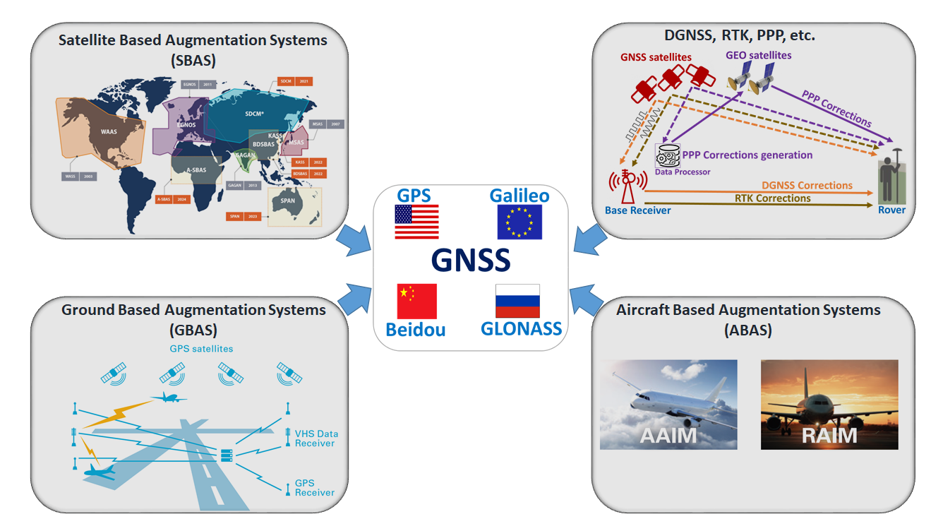
GNSS allows users with compatible receiver devices to determine their position, velocity and local time by processing signals from satellites in point positions within space. GNSS signals are provided by satellite systems called core constellation systems. The current core constellation systems are USA’s GPS, Europe’s Galileo, Russia’s GLONASS, and China’s Beidou. Technologies like DGNSS, RTK and PPP improve the accuracy while ABAS, GBAS and SBAS in addition to improving accuracy provide integrity, a measure of trust in the correctness of the information.
The use of GNSS position, navigation and timing information depends on operational requirements and encompasses different sectors from Aviation, Maritime, Road, Rail agriculture, consumer Location-Based Services, Geoformation to Timing and synchronization as well as Drones and Internet of Things (IoT) sectors.
Choose one of your services